Friday, April 29, 2011

Florida Day One


Day 28, April 29, 2011, Florida Day One

62.9 miles averaging 12.5 mph

Route from Dauphin Island, MS to Pensacola RV Park, Pensacola, FL

Best Moment – I met a woman on the ferry ride from Dauphin Island to Fort Morgan who had bicycled solo all of the way from San Diego.  She had been having a marvelous ride – it was fun to share experiences.  She had been an elementary school teacher, but has become disillusioned with the educational system in CA.  At one time she had ridden with her significant other from Boston to Seattle on a tandem.


Worst Moment – Orange Beach, Alabama is condo city and quite tacky with high rise after high rise all on the coast.  Many of the beaches in the area appear private and the traffic was a bit daunting.

I left Neita watching the Royal Wedding hoopla around 7:30 to catch the 8:00 am ferry to Fort Morgan.  It was a nearly 45 minute ride across Mobile Bay.  The pelicans and seagulls put on quite a show following the boat and crash-diving into the water.  The ferry only can take about 16 cars, and depending on tides and currents may or may not be able to accommodate motorhomes.  The tides were against Ruby, so Neita had quite a different drive than I did.


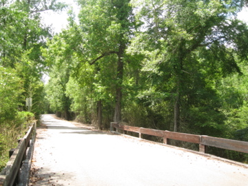
Went through some fantastic beach areas and huge condominium projects.  I preferred the beach areas where one could actually see the water.  The water in this part of the country is wonderful blue/green.  I entered the seventh state of the trip when I crossed the Florida state line. 


Pensacola RV Park is about fifteen miles off the route.  While actual route was wonderful, it was a bit more of a challenge to find where Ruby and Neita were. Since the route is a bit away from here, I’ll have to do some additional navigation to get back on course tomorrow.

It was good to get home early enough to fit in a haircut.

So it has been a month since the ride began.  It doesn’t seem possible that I’ve ridden nearly 2500 miles been in seven states all on a bicycle!  The next month is mainly in Florida – what a lot of coastline there is….


Dauphin Island!

Day 27, April 28, 2011, Dauphin Island

70.7 miles averaging 14.2 mph

Route from Vancleave, MS to Dauphin Island RV Park, Dauphin Island, AL

Best Moment – Seeing the spectacular white sand beach that seems to stretch for miles on Dauphin Island was certainly a highlight of the day!  After doing laundry and getting cleaned up, Neita and I were able to take Rocket and explore this extraordinary island.  This seems ever so much nicer than South Padre Island.  We were surprised that there weren’t more restaurants and other kinds of touristy places.
 

Worst Moment – Hearing about all of the destruction death that is taking place throughout the South just makes me heartsick.  Over 200 people died in Alabama and several others were killed or injured across this part of the country.

I’m in Alabama – the sixth state that I’ve ridden across.  I’ll not be here for long since we are in Florida tomorrow.


I went through the coastal forests and bogs then across part of Mobile Bay on a giant causeway onto Dauphin Island.  I stopped in Dees, AL at a pecan store. The owner told me that there are several cyclists riding cross-country.  There was a newlywed couple that started from New York in February and was spending a year.  Apparently the company that they both worked for gave them the time off with pay under the condition that they would write of their travels.  A whole year!  Wow!


The pecans from Dee’s Pecans are very tasty.  I got two different kinds – one chocolate Grand Marnier coated and the other a Cajun spice coated.  The chocolate coated ones – Yum!!


The island is quite historic.  The French first established a fort in 1699 on the eastern most tip of the island.  In 1803, it was claimed as part of the Louisiana Purchase, even though Spain controlled the island.  James Monroe commissioned the building of Fort Gaines which the Confederates seized in January 1861 and held until August 1864 when Farragut fought the Battle of Mobile Bay.

The island has been changed because of hurricanes.   As early as the 1700’s settlements were destroyed.  We were talking to a man who comes to Dauphin frequently and told us that the island still hasn’t recovered from Katrina – much of the tourist industry was destroyed then and just hasn’t reopened.  That’s why there are only two restaurants.

We all had a great time on the beach!


Wednesday, April 27, 2011

See Spot Run, See Spot Run After the Bicycle

Day 26, April 27, 2011, “See Spot Run, See Spot Run After the Bicycle”

77.3 miles averaging 13.1 mph

Route from Poplarville, to Bluff Creek RV Park, Vancleave,, MS

Best Moment – The weather forecast called for very stormy conditions starting around 11 am.  There was supposed to be a fairly high probability of thundershowers and strong gusty winds.  While it was certainly windy, cloudy and light rain did occasionally fall, there was nothing like I was expecting until several hours after I was safely here when the sky opened and we got a lot more rain and wind.


Worst Moment – No ice cream today.  The route today was incredibly beautiful, but also incredibly rural.  There were not any country stores to stop at for ice cream, Snickers or other sweet treat.  I had to be completely self reliant and just eat the healthy stuff that Neita gets for me to snack on.

Probably because of the nature of the roads that I’m cycling on, there will frequently be dogs that attack from either side of the rode and give chase.  Most of the time it is amusing and great sport for both the dog and for me.  However, if I’m having a difficult time with either the wind or hills it isn’t as much fun for me.  Today there must have been three or four different times when I was chased.  They never caught me, but one did come pretty close.

As I mentioned, the route today has been through an incredibly beautiful rural part of Mississippi.  It has been a bit of a challenge because these roads don’t have numbers or notices before the route changes so I have to be especially vigilant about street signs in order to stay on the route.


I went through part of the Harrison National Forest. I think that the Forest Service in the area really has its priorities right with the attached photo.  (The unfortunate part was that they also advertised it as a motorcycle route and the road was dirt.)


Bluff Creek is serene – no one is on the sandy beach - of course the weather is less than desirable.  The campground has some real Mississippi rednecks living here as permanent residents.


Tuesday, April 26, 2011

The Rain is Tess

Day 25, April 26, 2011,  “The Rain is Tess”

84.6 miles averaging 13.3 mph

Route from Independence, LA to Hass-Cienda Ranch, Poplarville, MS

Best Moment – Arriving at Ruby just before the rain hit again around 3:30 for a hard, but short rain shower.  Then being able to work on the real derailleur adjustments.  The bicycle school training came into good use – I think.  I’ll know for sure tomorrow.

Worst Moment – About 5:30 I woke up to the eerie glow of lightening and the ominous rumble of thunder.  By 6 it was raining in earnest.  This is the first rain day, and I must admit that I had some second thoughts about how much I really wanted to venture out in the shower.

Sometime during the hour or so of riding in the rain, as I was listening to the rain, traffic and birds, the old “Paint Your Wagon” show tune, “They Call the Wind Mariah,” came into my head.  "Away out here they have a name for Wind and Rain and Fire."  I know that it is pretty silly, but I had experienced the fire – Joe (in Texas), the rain – Tess (today), and more than enough wind – Mariah (most of the trip.)

After riding in a steady rain for about 90 minutes, things began to clear and dry up.  I spent most of the day riding through rural Louisiana into rural Mississippi.  There are beautiful farms/ranches, and timber.  The soil is red and sandy.  I collected quite a lot on my legs as the tires kicked up and coated me with dirt from the road.


Mississippi has dry counties – as you can see on the bottom line of the rules for the campground, “This is a dry county, please respect that.”  The sign certainly didn’t stop us from a glass of margarita when I got in.

Random Roadkill Remembrances

Day 24, April 25, 2011, Random Roadkill Remembrances

65.5 miles averaging 13.7 mph

Route from Baton Rouge to Indian Creek Campground, Independence, LA

Best Moment – Finding Pedal Play, having the bottom bracket re-tooled and re-packed and ready to go by 11 this morning.  I first went to Capitol Bicycle Shop – a huge place with an amazing selection of bicycles.  The guy there told me that he probably couldn’t look at my noisy bicycle and suggested that I try Pedal Play – about three miles further along.


I got to the store just as they were opening and Chris put my bicycle on the bike stand right away, check things out and get me back on the road.  Thanks Chris!

Worst Moment - These ill repaired Louisiana roads are killing me.  There are giant pot-holes big enough to swallow a Novara touring bicycle and its rider whole.  I’m certain that there are.  Then there are the non-existent shoulders along or so much junk along the side of the road, if there is a shoulder to ride it is un-rideable.  I don’t know what happened for highway funding here, but they need some.  The campground hostess mentioned that the road construction that Neita went through is much needed.  I couldn’t agree more.
This is not one of the roads I rode, but where I stopped for lunch

One of the things that occurred to me was just how much the road kill has changed.  In Texas it was mainly deer.  Here in LA there are all kinds of critters.  The most prevalent are the armadillos followed by possums, raccoons, and foxes. Interesting that there should be so many armadillos since one of the first days in Texas, there was a ranch founded by an individual that found ways to make baskets, purses and other items from the armadillo.  He raised them and built a network of tunnels for them – yet I didn’t see a single dead armadillo in Texas.

Here are some interesting signs from around the Baton Rouge area.  There apparently are still Blue Laws that prohibit selling alcohol by some establishments, yet (and I didn’t get the photo) there are signs advertising daiquiris and even daiquiris at two for the price of one.  It also seems to be a very patriotic and religious area with churches of all kind all over the place.  I saw church signboards indicating that “Christ paid for our sins, and we still get the Gift,” and “Christ paid for our sins, keep the change.”


Indian Creek Campground is lovely.  There are a lot of RV’s parked but there don’t seem to be many campers.  We’re thinking that some folks may leave the RV and just come here on weekends or holidays.  Sort of like a semi permanent second home.


Just finished listening to The Solitude of Prime Numbers.  It was an entertaining novel by an Italian author - Paolo Giodano

Monday, April 25, 2011

Happy Easter

Day 23, April 24, 2011 Happy Easter!

Rest Day – just exploring on Rocket

No miles on a bicycle about - 15 on the scooter

Best Moment  - The bucolic view from our picture window of the horses, the pasture and the stable makes a relaxing, pastoral scene.

Worst Moment – Naturally, I really missed spending today with Chris and Casey and friends – both Neita and I did.  This is the first Easter that we’ve not spent with them. They had invitations to spend the holiday with friends.  Thank you all for your offers to take them in!

So a recap:  So far, I’ve bicycled 1831 miles averaging about 13.5 mph and ridden 21 of the 23 days.  Five of those days were over 100 mile days.  I’ve cycled across parts of 4 different states.  And I’ve used 4 different route maps though three of them were for Texas.  I am amazed at how much I’ve seen from the Arizona desert to the Louisiana Bayou.  Now we’re headed to Florida!  One memorable TV moment was watching Carrie Underwood’s performance of “How Great Thou Art” on a Women of Country special.  I still get chills thinking about it.

Today we headed out on Rocket to explore Baton Rouge, I had copied parts of a bicycle trail map off the internet and thought that I knew were I was going.  Well, streets here run at weird angles – they certainly didn’t have the same ideas as the city planners of Phoenix as far as sensible urban planning.  Anyway, at one point I pulled over, yes Neita has trusted me to do the driving, to try to study the map I had and a couple knowing that I was obviously lost asked if we needed any help.  I told them I wanted to go downtown and they told us to follow them to the street that would take us to the Capitol District.  We followed them.  We got there. Nice!

The area around the capitol was empty, as was the levee area.  We stopped at a riverfront restaurant for lunch, Bloody Mary’s and Po-Boys and watched the river barges heading upstream. One of the barge pushers had 8 barges in front of it!  (Seems like a lot of stuff.) The Mississippi is gigantic!  Neita took several photos of the bridge she had to cross coming into town.  I didn’t have my camera – that’s why no photos today.  On our way home we went through the LSU campus.  It is beautiful and seems huge!

Sunday, April 24, 2011

Crossing the Mississippi

Day 22, April 23, 2011, 3 Days, Crossing the Mississippi

Route from Marksville to Farr Equestrian and RV Park, Baton Rouge, LA

101 miles averaging 11.9 mph That makes three centuries in three days – yuck.

Best Moment – I just caught the ferry just in time.  I was the last person to get on the ferry to cross the Mississippi before it left for St Francisville.  Wow!  Then there was the Wyoming sign in town.  Apparently, there had been a Wyoming, Louisiana, imagine that!


Worst Moment – Will these winds ever stop blowing?  There have been wind warnings posted for the Baton Rouge area.  I spent another day of riding into the wind and I am getting tired of it. Today, unfortunately, I never benefited from a tail wind even for a little while.

Today I crossed major rivers!  First was the Atchafalaya River just outside Simmesport.  The bridge was huge – it’s interesting how the levees are built up around major rivers here like the Atchafalaya and the Mississippi.  What a difference in scenery since I left Arizona just over three weeks ago!
 View from Ferry
Bridge over Mississippi

After crossing the Mississippi, I stopped in St. Francisville, a charming, historic town started in 1785 on the hills above the Mississippi.  A coffee shop advertised strawberry pie.  I couldn’t resist. It was very tasty!

The river dominates everything around it.  There are the levees built on either side and instead of bridges at every crossing, there are frequently ferries to transport one across.  I was a bit worried that Neita would have to get on one of the ferries, but fortunately was routed to I-10 and a HUGE bridge.

Then there was the five mile long spillway near Morganza that I’m certain is used for flood control.  Finally in Baton Rouge, I took Scenic Drive to River Road to the RV Park.  The Scenic Drive was anything but scenic (unless, you are interested in industrial parks.)  I went past plants for Exxon, and more plants for Exxon, Honeywell and lots of other industry.

At River Road, other than the LSU stadium, all I really saw was the levee – good thing it is there.  I understand that there are flood warnings out – not because of any rain here, but whatever is going on upriver.  It really is incredible to consider that there could be so much more water in the river to make it flood the levees.


The roads in Louisiana are the worst I’ve been of the trip so far.  They are rutted, pot holed and generally in bad repair.  They are teeth rattling, bone jarring, bicycle wheel destroying.   I think that cobblestone would have made a preferable riding surface.
Scenic, maybe but certainly built in Colonial times and not repaired since. 
Tomorrow is a REST DAY!!!  

Not a Mercedes in Sight

Day 21 April 22, 2011, Not a Mercedes in Sight

Route from to Coushatta to Paragon RV Park Marksville, LA

118.6 miles averaging 13.9 mph
Bottom line reads "Trip Dist 118.63"

Best Moment – There is a MacDonald’s on the right hand side of the road just as I was turning into the RV Park about 6:30.  Oh my gosh, did it ever smell wonderful.  I nearly stayed there, but “home” was very close so I passed it by.

Worst Moment – These off the route campgrounds are beginning to be annoying.  Last night’s Red Shoes campground was about 6 miles off the route and tonight’s was nearly 10 miles out of my way.  That means that I rode 16 more miles today than planned.  However, in order to get all of the hook-ups for the RV, we’ve had to go a bit further.  When I was planning the route, I didn’t know just how far some of these sites were nor how big an impact it would have.

Today’s route was mainly agricultural.  I am pretty certain that this is a rice paddy.  There was another area, where the farmer was in a skiff with some sort of machine attached.  He was apparently working the soil underneath the water.  Then there were acres of grain and hay.  Doesn’t the second photo look like someone left giant marshmallows in the field?


I can see why they need signs like this.  The topography is flat.  I’ve also seen Hurricane Shelters.  Sort of makes what I’ve read about these monster storms more impactful than before.


One of the things that I’ve noticed is that I haven’t seen a Mercedes, BMW, Audi, or any other luxury type car for the past several days.  There are Japanese, Korean, and American cars with lots of Toyotas, Nissans, Chevy’s and Fords, but no German cars.  This is not an affluent area.

People really do talk differently down here in Louisiana.  It is almost like they are speaking a foreign language.  The words are spoken very slowly, but all run together making it difficult to understand.  In the store in Washington, LA where I stopped to get water two high school girls were behind the counter and asked me “Hoow  faar dju ryide?”  At first I really didn’t understand what they were asking and must have sounded as foreign to them because I’m fairly certain that Oberlin is pronounced differently here than the way that I say it.


One last observation of the area is that dentistry is not top on the priority list.  I’ve seen a lot of folks with missing teeth, crooked teeth, and neglected teeth.  It really makes Neita and I appreciate all of the things that our parents did for us – not only in dentistry, but the encouragement that we were given to get our education, and to aspire and achieve more.

Saturday, April 23, 2011

Louisiana Finally

Day 20, April 21, 2011 – Louisiana Finally!


Route from Silsbee TX to Red Shoes RV Park Coushatta, LA

116 miles averaging 13.9 mph

Best Moment – It was certainly good news when I heard from Neita that everything on Ruby was fixable and she would be in Coushatta tonight.  The repair folks came to us and found that there was junk like Styrofoam and wood in our grey water tank that was keeping the valve stuck open.  They replaced the valve, which was no easy task due to very tight working spaces.  It was a shitty job, but someone had to do it.

Worst Moment – I really hate when county/state highway departments let junk stay on the shoulder of the road things like tire parts, glass, trees and little tiny wires that caused the third flat of the trip.  The roads in Louisiana do not seem quite as well maintained as those in Texas.
Just one road hazard & evidence of the logging industry

For about 30 miles going out of Silsbee, I had an amazing tail wind and was able to average about 16.3 mph for two hours.  Well, you can guess that I also had to deal with a bit of head and cross winds, otherwise I would have been at Red Shoes before Neita.

The route was mainly through pine forests.  Lots of logging and wood chip filled trucks passed me.  The fragrance of freshly cut wood and honeysuckle permeated the air.   There was an area around Mittie, Louisiana that seemed to have lots of tourism recreation centered on the Chitta River.  There were two canoe companies where one could rent canoes and be picked up down river.  I don’t know how anyone could canoe very far or fast.  The river looked barely wet.  It did make me think of Burke’s Canoes in Guerneville.


As I rolled into Red Shoes RV Park around 6:30, the carnival was going full swing.  Pretty amazing to be here in the middle of nowhere and there was a huge RV park, several motels and a giant casino with a carnival.


In case you are interested in making a donation in my name to the Lance Armstrong Foundation, here is my link.  I’ve raised $2500 so far over the two years of my campaign. http://grassroots2011.livestrong.org/billsbigride197

Wednesday, April 20, 2011

This isn't Pima Road

Day 19, April 20, 2011

Route from Coldspring to Red Cloud RV Park, Silsbee, TX

71.6 miles averaging 13.1 mph

Best Moment – West Texas Style Bar-B-Que’s coconut cream pie for dessert.  After smelling barbeque for about two weeks we finally went to try a place recommended to us by the manager of the RV Park.  This was about a half mile from the park and an easy ride on Rocket.


Worst Moment – Neita wrecked Ruby and the “dump valve” is stuck open.  Getting to Silsbee wasn’t easy for Neita.  Her GPS was giving her really wacko directions on finding the RV Park.  Probably because there are a lot of parts to Hwy 96 N – like there is a S 96 N and Business 96 N and you get the picture.  Anyway somewhere in town she wiped out the mirror on the passenger side.

To make matters worse, the “dump valve” for the grey (thank heavens not the black) water had been stuck open since the last time I cleared the tanks in Bastrop.  When I tried to attach the hose, all the grey water started gushing out.  There is a guy here that makes “RV” calls and is supposed to be here tomorrow to get us back up and working. Let’s hope so.

The route went through some pretty amazing forested areas.  There is lots of timber and logging going on.  In fact this afternoon I was talking to one of the full time residents of the RV Park who is a maintenance guy for the paper mill in town.  This mill makes all of the paper for the Starbuck’s coffee cups.


I know that they have to get the wood from somewhere, but I’m still a bit of a tree hugger and wish that they wouldn’t clear cut as they had around this part of the state.

There have been lots of butterflies along the road.  I’ve seen several different varieties and though that these photos were pretty good.


This is the last night in Texas, (I hope).  After nearly 1100 miles and 14 nights we should be in Louisiana tomorrow!  What a lot of diversity in the state from the dry barren parts around El Paso where agriculture depends solely on the Rio Grande to the Hill Country, and now to the pine forests.  The climate has also really changed from being very dry to very humid.  As I leave Silsbee tomorrow, the humidity is projected to be near 100% (But there is no rain forecast – is there a difference?)

I’ve been listening to Sin in the Second City and interesting true story about a house of prostitution in Chicago during the early 1900’s.   Also, I finished listening to Silas Marner.  I’d read it in maybe Junior High, but it was much improved this time around.

I can’t begin to tell you how much I appreciate your comments, emails, texts, and calls – they really do mean a lot to me.  In case you are interested in making a donation in my name to the Lance Armstrong Foundation, here is my link.  I’ve raised $2500 so far over the two years of my campaign. http://grassroots2011.livestrong.org/billsbigride197